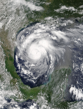
When Hurricane Harvey hit Texas, the Federal Aviation Administration was quick to put up a temporary no-fly zone over Houston and the surrounding areas. All drone operations were excluded unless they had express permission from the FAA. Within the first ten days, over a hundred authorisations were issued. Usually it was for drones that were being used by or on behalf of government agencies.
The Red Cross unmanned aircraft response team, in conjunction with drone photography company Propellor Heads, was on the scene in order to provide aerial views of the ongoing natural disaster, meaning search-and-rescue operations had an extra set of eyes in the sky.
In the aftermath of the hurricane, the UAVs’ work has not been completed. In fact, it has begun in earnest. With more than 30,000 houses flooded and up to a million vehicles waterlogged, the estimated damage caused could total around $120 billion, making it the most expensive natural disaster in the USA’s history.
Drones can now assist in inspection work, assessing the extent of the damage not only to homes, but areas of important infrastructure such as bridges, power lines, roads, and oil and gas facilities. They will also be able to help inform on when it is safe to return to the area. Verizon announced that it had used drones to conduct cell tower inspections to survey the damage and to aid recovery. Both sides of drone regulation have been seen in the Texas area, with temporary prohibition of civilian drones to keep the airspace clear for the permitted drones that were able to speed up recovery after the emergency.
Drone footage has emerged from the areas impacted by Hurricane Irma, such as Florida and the Caribbean, as the hurricane season continues and the relief efforts begin.
References: Dronelife UAV Expert News


.jpg)
.jpg)
.jpg)

.jpg)
.jpg)


.jpg)